
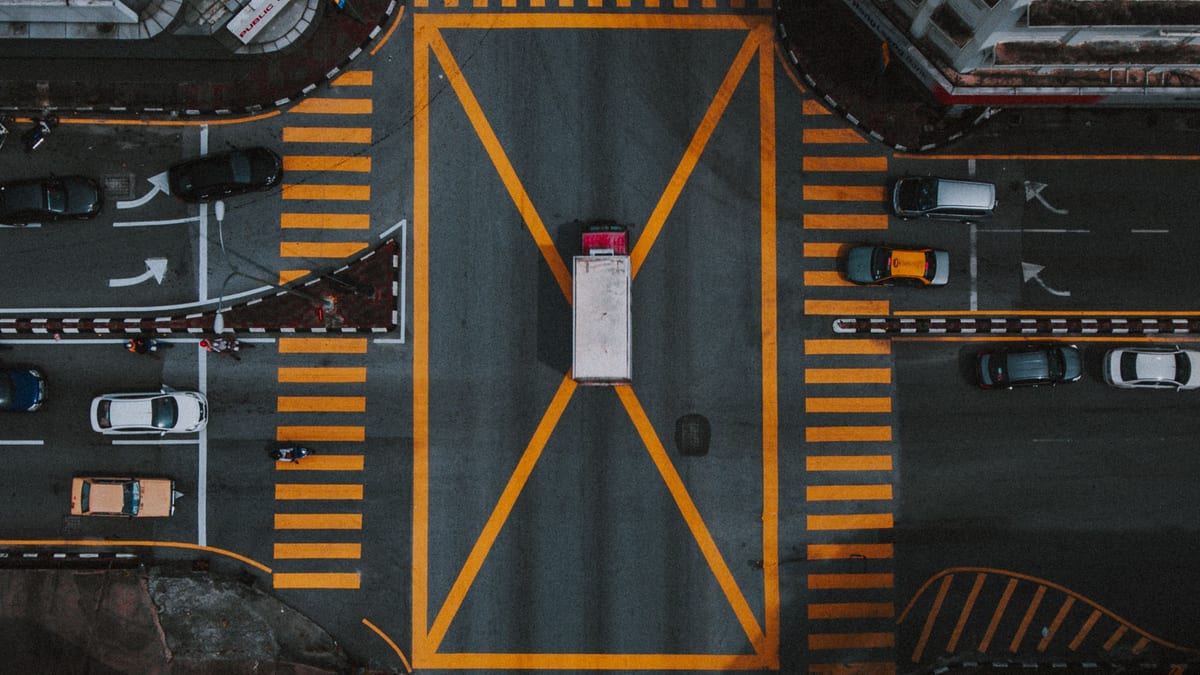
Quick answer: most listings in India do not need a drone. A drone earns its cost when land, surroundings or scale are part of what you are selling — a plot, a farmhouse, a large site. If you do fly, the operator needs a Remote Pilot Certificate, the drone needs a registration number, and the exact location needs a zone check on the Digital Sky map. Five to eight seconds of aerial is usually enough.
Key takeaways
- A drone answers two buyer questions well — where is this, and how big is it. It answers nothing about rooms, light or finish.
- Commercial property work is not hobby flying. The certificate, the registration and the third-party insurance all belong to whoever holds the controller.
- Zones are vertical as well as horizontal. The same rooftop can be green at low height and yellow higher up, which is the check most people miss.
- Airport bands are measured from the airport perimeter, not the terminal, and they decide the shoot date more often than the budget does.
- The footage that fails review is almost never badly flown. It is beautifully flown and answers no question the buyer asked.
Does this property actually need a drone?
This is the question to settle before you call anyone, because it decides the budget, the timeline and whether you need a permission at all. Brokers tend to ask whether they can afford a drone; the more useful question is whether the property has anything to say from the air.
| Path | Use it when | Reconsider it when |
|---|---|---|
| No drone | The property is one unit inside a building — a 3BHK builder floor in Rohini, a flat in a society tower, an office floor. The buyer is deciding on rooms, light, parking and the staircase. | The building itself is the selling point, or the block has frontage on a main road that a photograph cannot show. |
| Short aerial insert, 5–8 s | The setting is part of the value — a farmhouse on Chhatarpur road, a villa backing onto green belt, a corner plot whose two-side access you keep explaining on calls. | The surroundings are half-built or contested, or the neighbouring plot is a construction site you would rather the buyer met in person. |
| Full aerial sequence | The land is the product — a plotted colony, a two-acre site, a project launch where road, boundary and phase layout are the whole pitch. | Boundaries are not demarcated on the ground, or approvals are pending and an aerial makes the site look further along than it is. |
The middle row is where most Indian listings land, and it is the row brokers skip. One well-placed aerial insert costs a fraction of a full sequence and does almost all of the work, because the buyer only needs the location answered once.
What we see in brokers’ aerial footage
Brokers send us footage to cut into reels, so we see a lot of drone material that was already paid for. The problems repeat, and none of them is about the pilot’s skill.
Altitude is a point of view, not a strategy
The most common file we receive is a slow rise to maximum height over the roof. It is smooth, it is well exposed, and by the third second the property has become a grey rectangle among other grey rectangles. Height flattens exactly the things that distinguish a property — the depth of a setback, the width of a road, the height of a boundary wall — so past a point every additional metre removes information rather than adding it.
The aerials that survive an edit are usually shot lower than the pilot expected to fly, close enough that the property stays the largest thing in frame.
The ground shot finishes the thought
An aerial raises a question it cannot answer. The viewer sees a plot with a road on two sides and immediately wants to know what the road looks like from the gate. When the next clip is another aerial from a different angle, the question stays open and attention drops.
We cut aerials so that each one is followed by the ground shot that answers it, which usually means the shoot needs a shot list covering both, agreed before the operator arrives rather than assembled afterwards from whatever was captured.
The pilot owns the flight decision
Brokers sometimes ask an operator to fly somewhere the operator has said no to, on the basis that it is a short flight or a small drone. That is the broker asking someone else to carry a penalty on their behalf. The certificate, the registration and the insurance are in the operator’s name, and so is the liability when a flight goes into airspace it should not.
A good operator refusing a location is doing their job, and the right response is to change the shot rather than the operator.
Three shots that usually earn their place
Across the footage we cut, three aerials survive review often enough to plan for. Everything else tends to be coverage.
- The arrival shot. A low, steady move toward the property along the approach a visitor would actually take. It tells the buyer what they will see when they turn in, which is the first thing they will compare against on a site visit.
- The relationship shot. One frame holding both the property and the thing that makes it valuable — the main road, the metro line, the school, the green belt. This is the only shot that proves a location claim instead of asserting it, and it is the one most often missing.
- The scale shot. A wide frame with the full boundary in boundaries, used once, for plots and large sites where the buyer genuinely cannot judge size from the ground. On a built unit it is decoration.
The rules in India, in plain words
This section is the compliance part of a planning guide, not legal advice, and it is deliberately short. What a broker needs is enough to brief an operator, check a claim and avoid booking a shoot that cannot legally happen.
The 249-gram question, and why commercial use is the real line
The Drone Rules 2021 sort drones by all-up weight: nano at 250 grams and under, micro above 250 grams up to 2 kg, small above 2 kg up to 25 kg, medium up to 150 kg and large above that. Most consumer drones sold in India are built to 249 grams precisely so they land in the lightest category, and that number is printed on the box for a reason.
Do not let the number end the conversation. A property shoot is commercial work, and commercial operation brings obligations that recreational flying does not — registration of the aircraft, insurance, and full responsibility for the airspace you enter, none of which the weight on the box removes. In practice the operator you hire for a site of any size will be flying something heavier than 249 grams anyway, which puts the certificate question back on the table.
Registration and the Remote Pilot Certificate
Two separate things. The drone gets a unique identification number, a one-time registration on the Digital Sky platform that stays with the aircraft; the statutory fee is nominal, reported at around ₹100 — verify the current figure on Digital Sky. The person gets a Remote Pilot Certificate, issued digitally after training at a DGCA-approved remote pilot training organisation and valid for ten years.
We are not quoting a price for the certificate, because the published figures disagree by an order of magnitude and the real cost is the training course rather than the government fee. It is also not your cost — it is the operator’s, and it is part of why a certified operator quotes more than someone with a drone and a weekend free.
The Digital Sky map, and green, yellow and red
India’s airspace for drones is published as a colour-coded map on the Digital Sky platform, and it is free to view without logging in. Green is the airspace from the ground up to 400 feet, or 120 metres, above ground level where nothing else is designated. Yellow needs prior permission from the controlling authority — AAI, the Air Force, the Navy or HAL, depending on whose airspace it is. Red is a no-drone zone that only central government permission opens.
The detail that catches people is that yellow is defined partly by height. Yellow includes the airspace above 400 feet over a green zone, so the same point on the ground is green low and yellow higher up, and an operator who checked the map at ground level has not actually checked the flight.
The airport problem in Delhi NCR, Mumbai and Bengaluru
Airport bands are the single most common reason a shoot in these cities cannot happen on the day you want it. Under the published definitions, the band from 5 km to 8 km from an operational airport perimeter is yellow at any altitude, and the band from 8 km to 12 km is green up to 200 feet, or 60 metres, and yellow above that. The yellow radius was reduced to 12 km from a far larger one, which is why older guidance you may find online is stricter than the current position.
Two cautions. The distances run from the airport perimeter, not the terminal, which moves the rings further out than people expect in Delhi NCR and Bengaluru. And what applies inside 5 km is whatever the map designates for that specific location rather than a single blanket rule — check the pin on the current Digital Sky map rather than assuming.
Borders, insurance and penalties
Operations close to an international border, including the Line of Control and the Line of Actual Control, are prohibited within a wide belt — 25 km is the figure in circulation — and those areas appear as red on the map, which is the practical check. Third-party insurance is mandatory for commercial drone operations, with the lightest category treated differently; ask the operator for the policy, not a reassurance.
Penalties run to ₹1,00,000 for serious non-compliance, such as flying a red zone or operating commercially without the required certificate, and conduct that endangers safety carries criminal liability under the Aircraft Act rather than only a fine. For a broker the exposure is reputational as much as legal: the shoot is on your listing, for your client.
The two permissions DGCA does not give you
Clearing the airspace is not the same as being allowed to fly. Two permissions sit outside the aviation rules entirely, and both are routinely skipped.
- The RWA or society. Most gated societies and resident welfare associations have their own position on drones, and a committee that finds out afterwards can make your client’s life difficult long after the reel is published.
- The builder or landowner. On a project site the developer controls what may be photographed and published, and on private land you need the owner’s consent even when you are representing the sale.
Privacy is the quiet one. A drone at a low height over a dense colony looks into neighbours’ terraces, courtyards and windows, and nobody in those frames agreed to appear in a marketing video. Brief the operator to keep neighbouring properties out of frame, and cut anything that survives to the edit.
This is general guidance for planning a shoot, not legal advice. Drone rules in India have changed repeatedly and the airspace map is updated, so confirm the current position on the Digital Sky platform before any flight, and take professional advice where a decision carries real consequences.
From address to approved aerial edit
- Write the buyer question first. One sentence: what will a buyer understand after this footage that they could not understand before? If you cannot write it, you have found your answer about whether to fly.
- Choose an operator who holds the certificate, and ask to see it. A certified operator will send it without taking offence. Someone who treats the question as distrust is telling you something useful.
- Run a zone check for the exact pin. Not the locality, not the sector — the coordinates of the property, checked on the Digital Sky map, at the height you intend to fly. Do this before you promise the client a date.
- Build a decision-led shot list. Three or four aerials tied to specific questions beat twenty minutes of coverage, and they shorten the flight, which shortens the bill.
- Connect air to ground. For every aerial, name the ground shot that follows it. This is the step that turns footage into a sequence, and it costs nothing on the day.
- Review for truth and pacing. Cut anything that implies a boundary, an amenity or a view the property does not have, then cut the aerials again for length. Five to eight seconds each, twice at most.
Worked example
A 500 sq yd plot in a plotted colony in Greater Noida West. The road is wide and finished, the colony is roughly half occupied, and the plot immediately to the left has a half-built structure with exposed brick and scaffolding. The buyer question is straightforward: how big is this, and what is around it?
What gets shot is a low arrival move along the internal road toward the plot, one scale frame holding the full boundary with the road on two sides, and one relationship frame that includes the main approach road without lingering on the neighbouring construction. Total flight time is short, because the list is three shots and not an afternoon.
What gets cut is the high overview that makes the colony look emptier than it is, and the orbit that swings across the half-built neighbour for two full seconds. Neither is dishonest by intention, and both invite a specific objection the property does not deserve — one suggests a dead colony, the other puts someone else’s construction site in your client’s advertisement.
We would also refuse to draw the plot boundary onto the aerial frame, which brokers ask for often. The moment a line appears over land it stops being a photograph and becomes a representation of an area, and on plotted land measured in gaj that is a claim a buyer can hold you to.
What it costs in India
Drone pricing varies more by city and operator than by property, and published figures are inconsistent enough that every number below should be treated as a starting point for a local quote rather than a rate.
| Scope | Typical range | What drives it |
|---|---|---|
| Basic single-property shoot | From about ₹5,000–₹6,000 — verify locally | Travel to site, one short flight, minimal editing. The low end usually means raw files rather than a finished edit. |
| Half-day site shoot | From about ₹15,000 — verify locally | Three to four hours on site, multiple angles, some post-production. The common shape for a project or a large plot. |
| Full-day with ground coverage | From about ₹30,000 — verify locally | A full day, golden-hour timing, ground B-roll and a cut video. Metro cities price higher; remote sites add travel. |
Set that against what the same money buys elsewhere. ReyAI Starter is ₹1,999 a month and Pro is ₹3,799 a month, and both produce reels from photographs you already have across many listings rather than one. The honest comparison is not that one replaces the other — a drone captures something a photograph cannot — but that a single half-day aerial shoot costs more than several months of producing video for your whole portfolio, which is worth knowing before you spend it on one plot.
If you want the mechanics of the photo-based route, we set it out in our guide to photo to video for real estate.
Where this usually breaks
| Risk | Practical control |
|---|---|
| Flying a yellow or red zone without permission | Zone check on the exact coordinates before the date is promised, at the intended height. Keep the operator's permission reference with the listing file. |
| Implying boundaries on plotted land | No lines, arrows or shaded areas drawn over an aerial frame. A boundary drawn on a picture reads as a measured claim, and on land sold in gaj or bigha it will be treated as one. |
| Showing neighbours' terraces and windows | Brief it before the flight and enforce it in the edit. Nobody in a neighbouring frame consented to appear in an advertisement. |
| Beautiful footage that answers no question | The one-sentence buyer question from step 1. If a clip does not answer it, it is coverage, and coverage belongs on the cutting-room floor. |
| RERA projects showing unbuilt amenities | Aerials of a site under construction must not be cut to suggest a completed clubhouse, pool or landscaping. Show the stage the project is actually at, and say so. |
Measure clarity, not flight time
Operators quote in minutes flown and deliver in gigabytes, and neither tells you whether the footage worked. Three measures are worth tracking across listings.
| Measure | What it tells you |
|---|---|
| Aerial seconds in the published cut | How much of what you paid for survived review. Consistently under ten seconds means the next shoot should be scoped smaller, not cancelled. |
| Location questions on enquiry calls | If buyers still open with "where exactly is this", the relationship shot is missing or it is not early enough in the reel. |
| Site visits per enquiry | Aerials that match what a visitor finds raise this. Aerials that flatter a site lower it, because the visit becomes a correction. |
Our bottom line
A drone is a specific instrument for a specific job: showing land, setting and scale. On the listings where that is the pitch — plots, farmhouses, large sites, launches — it is worth the cost and the paperwork, and the paperwork is genuinely manageable once you know to ask the operator for a certificate and to check the pin rather than the locality. On the far larger number of listings where the buyer is deciding between two flats, it is money spent on a shot that answers a question nobody asked. Our advice to the brokers whose footage we cut is unchanged: decide the buyer question first, fly only if the answer is above the ground, and keep the aerial short enough that the property is still the subject.
Sources and research notes
Every regulatory figure here was supplied and then re-checked against published sources on 21 September 2026. Two official routes were unreachable at the time of writing — the Digital Sky airspace map returned an expired TLS certificate, and the Drone Rules 2021 PDF on the civil aviation ministry site returned 403 — so the zone definitions below are quoted from the government’s own press release rather than from the map itself. Confirm anything load-bearing on Digital Sky before you rely on it.
- Ministry of Civil Aviation press release on the release of the airspace map for drone operations, which carries the green, yellow and red zone definitions and the 400-foot, 200-foot, 8–12 km and 5–8 km figures used above — pib.gov.in, checked 21 September 2026.
- Digital Sky platform, for the current airspace map and the registration and certificate process — digitalsky.dgca.gov.in, checked 21 September 2026 (certificate expired at the time of checking).
- Drone Rules 2021 as notified by the Ministry of Civil Aviation, for the weight categories and the fee and insurance provisions — civilaviation.gov.in, checked 21 September 2026.
- Published Indian drone shoot pricing used for the cost table — Alliance Media Labs and AerialPhotoIndia, both checked 21 September 2026. Commercial operators quoting their own rates; treat as indicative.
Read Next
EnglishLow Density Area Under MPD-2047 — What It Covers and What's Excluded
MPD-2047 designates a Low Density Area covering one peripheral village revenue boundary along the NCT border, replacing the earlier LDRA.
28 August 2026- Luxury Brochure Without a DesignerEnglish · 2 min read
- Property Photo Se Cinematic Video — Bina Videographer KeHinglish · 2 min read
- RERA Agent Registration — Who Needs It and How to ApplyEnglish · 2 min read
- Delhi Master Plan 2047 — What Was Actually Approved, and What ChangesEnglish · 6 min read
Frequently asked questions
Do I need a licence to fly a drone for a property video in India?
You do not — your operator does. Under the Drone Rules 2021 a Remote Pilot Certificate is issued to a person after training at a DGCA-approved RPTO, and the drone itself carries a unique identification number. A property shoot is commercial work, so ask to see both before the flight and keep a copy on file. Lighter drones sit in lower categories with fewer requirements, but the exemptions are narrower than the marketing on the box suggests.
How long should drone footage be in a listing reel?
Usually five to eight seconds, and rarely more than twice in one reel. Aerial footage answers where a property sits and how big it is; once it has answered that, it repeats itself. The reels that hold attention use one aerial to establish the site and then cut to the ground, because a buyer decides on rooms, light and finish, and none of those are visible from 120 metres up.
Can I fly a drone near an airport in Delhi NCR or Mumbai?
Not freely, and the answer depends on the exact pin rather than the city. Under the published zone definitions the band between 5 km and 8 km from an operational airport perimeter is yellow at any altitude, and the band between 8 km and 12 km is green up to 200 feet and yellow above it. Yellow means prior permission from the controlling authority. Check the specific coordinates on the Digital Sky airspace map before committing to a shoot date.
Is a drone worth it for a normal flat or builder floor?
Usually not. A drone earns its cost when the land, the surroundings or the scale of a property is part of what is being sold — a plot, a farmhouse, a large site, a project with real frontage. For a 3BHK builder floor the buyer's questions are about rooms, light, parking and the staircase, and an aerial shot of the roof answers none of them. The money is better spent on the interior photographs.